A Road Map is one of the more popular types of maps. These maps show minor and major highways and roads (based on detail) along with things like airports, city locations, and interesting attractions, such as, parks, campgrounds, and monuments.
A Road Map or route map is a form of navigational map that primarily displays roads and transport links instead of natural geographical information.
Major highways with a road map are usually red and bigger than other roads, while minor roads can be a lighter color and a smaller line.
Climate Map
A Climate Map shows knowledge about the climate of a region.
Their able to display things like the precise climatic zones of an area using the temperature, such as, how much snow an area gets or average amount of cloudy days.
These maps normally use colors to point out different climatic areas.
Physical Map
The definition of a Physical Map is a description of the geographical features of a location.
Physical maps can include a lot of identical information available on a political map, however, their main function is to indicate land forms like deserts, mountains, lakes and plains. Their topography style provides a complete picture of the local terrain.
A physical map displays the natural landscape characteristics of an area.
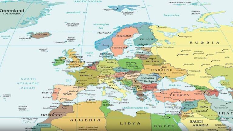
Political Map
Political Maps are made to show governmental boundaries of nations, states, counties, cities and towns, and might have some physical features such as rivers, streams, and lakes. The characteristic of a Political Map is a simple to use detailed index.
Political Maps will not indicate any topographic features. It instead focuses just on the national and state borders of a region. They will also add the location of key cities, plus they usually include significant bodies of water, according to the details in the map. Although some physical features show up on Political Maps, including major mountain ranges, the use of this is to provide geographical reference indicating any physical features. These boundaries and locations are usually based on people instead of the natural world.
Choose One of Our Most Popular Map Designs
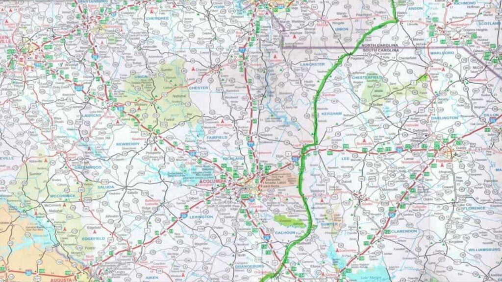
Road Map
A Road Map is one of the more popular types of maps. These maps show minor and major highways and roads (based on detail) along with things like airports, city locations, and interesting attractions, such as, parks, campgrounds, and monuments.
A Road Map or route map is a form of navigational map that primarily displays roads and transport links instead of natural geographical information.
Major highways with a road map are usually red and bigger than other roads, while minor roads can be a lighter color and a smaller line.
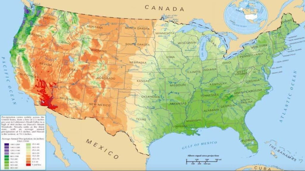
Physical Map
The definition of a Physical Map is a description of the geographical features of a location.
Physical maps can include a lot of identical information available on a political map, however, their main function is to indicate land forms like deserts, mountains, lakes and plains. Their topography style provides a complete picture of the local terrain.
A physical map displays the natural landscape characteristics of an area.
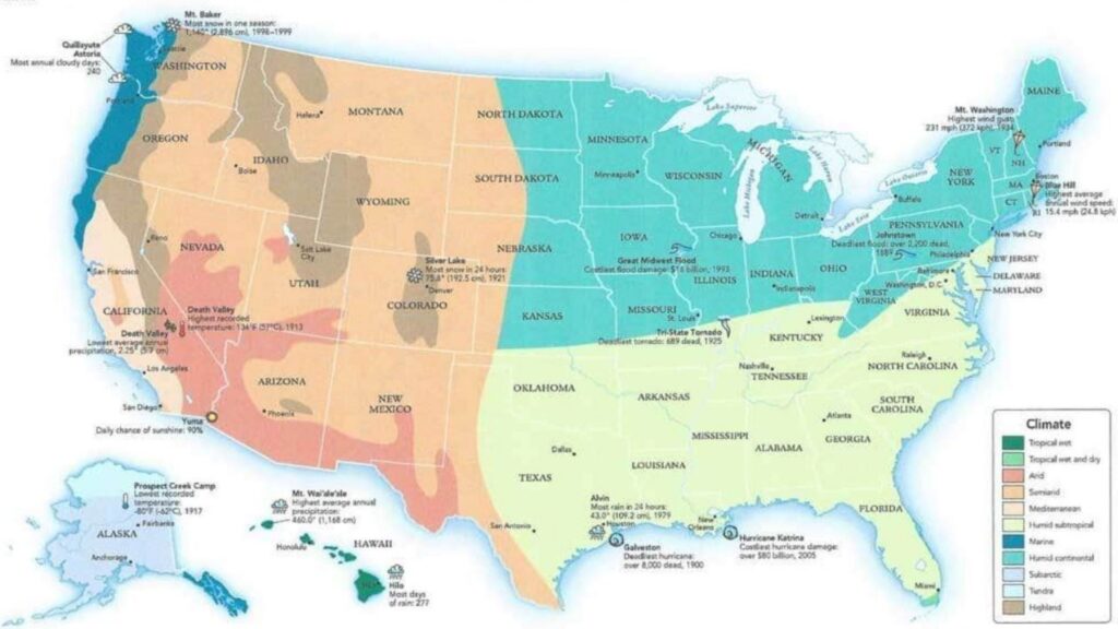
Climate Map
A Climate Map shows knowledge about the climate of a region.
Their able to display things like the precise climatic zones of an area using the temperature, such as, how much snow an area gets or average amount of cloudy days.
These maps normally use colors to point out different climatic areas.
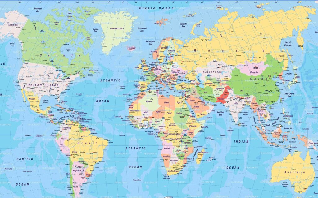
Political Map
Political Maps are made to show governmental boundaries of nations, states, counties, cities and towns, and might have some physical features such as rivers, streams, and lakes. The characteristic of a Political Map is a simple to use detailed index.
Political Maps will not indicate any topographic features. It instead focuses just on the national and state borders of a region. They will also add the location of key cities, plus they usually include significant bodies of water, according to the details in the map. Although some physical features show up on Political Maps, including major mountain ranges, the use of this is to provide geographical reference indicating any physical features. These boundaries and locations are usually based on people instead of the natural world.
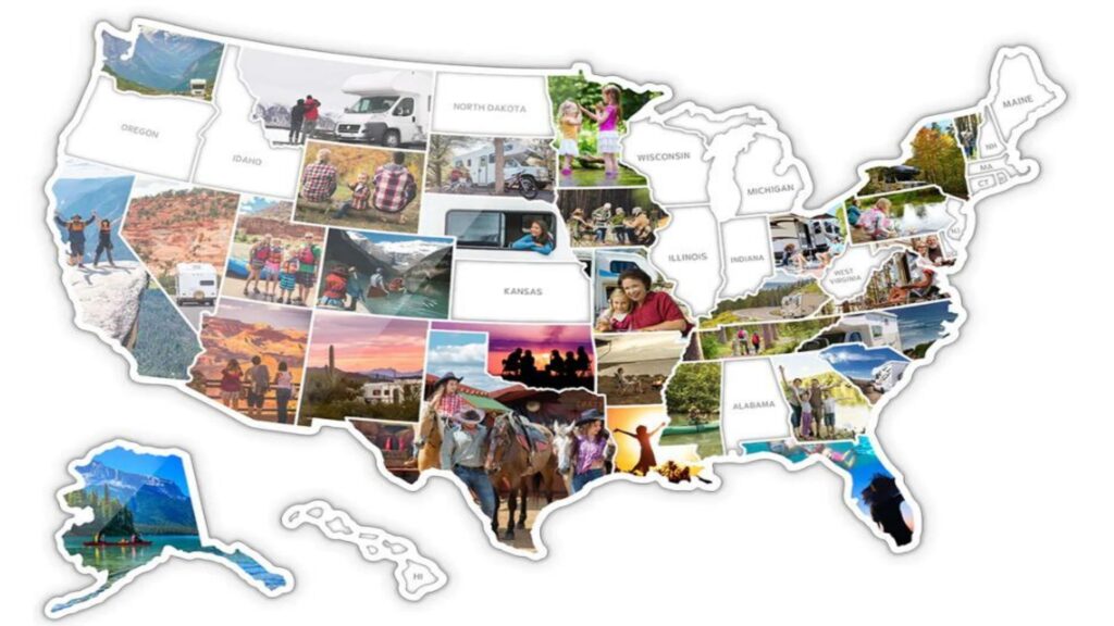
Photo Map
Your Photos.
Your Journey.
You supply your favorite photos and we will resize and place each photo into this beautiful United States of America Collage. Invite all of your friends and family over to show off your new masterpiece.
This will be a focal point of discussion topics, for many years to come.
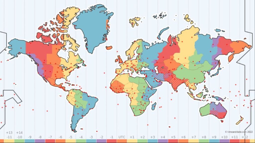
US &international Time Zone Maps
All clock changes worldwide are automatically taken into account and displayed in real-time before creating this masterpiece. This stunning beauty can be printed or used on Desktop. Future changes are usually incorporated into our database before they take effect, so the map accurately reflects the current situation.
Please note that the Time Zone Map is not a political map but a time zone map showing thetime zone boundaries.
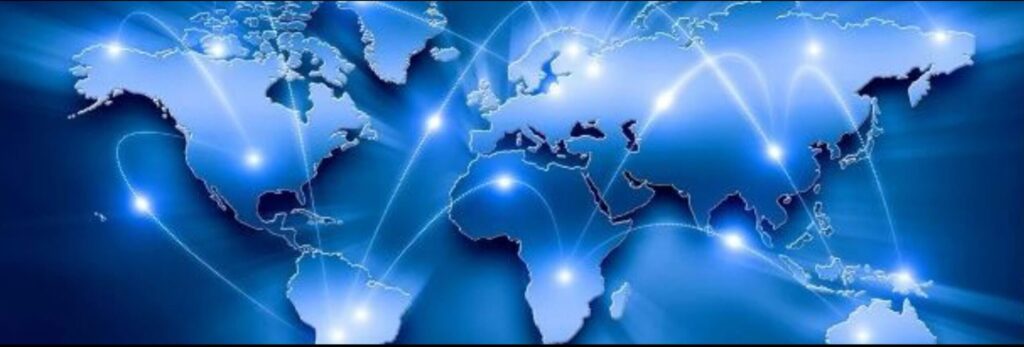
Custom Maps
We will create your stunning & fully Custom Map to the exact size and specifications of your choosing.
This map can be used for any intended purpose, and we can craft this onto any material requested.
Enjoy this crafted masterpiece for many years to come. The sky is the limit here (No Pun Intended).
Photo Map
Your Photos.
Your Journey.
You supply your favorite photos and we will resize and place each photo into this beautiful United States of America Collage. Invite all of your friends and family over to show off your new masterpiece.
This will be a focal point of discussion topics, for many years to come.
US &international Time Zone Maps
All clock changes worldwide are automatically taken into account and displayed in real-time before creating this masterpiece. This stunning beauty can be printed or used on Desktop. Future changes are usually incorporated into our database before they take effect, so the map accurately reflects the current situation.
Please note that the Time Zone Map is not a political map but a time zone map showing thetime zone boundaries.
Custom Maps
We will create your stunning & fully Custom Map to the exact size and specifications of your choosing.
This map can be used for any intended purpose, and we can craft this onto any material requested.
Enjoy this crafted masterpiece for many years to come. The sky is the limit here (No Pun Intended).